C-GEO enables importation of survey data from geodetic instruments.
Create and print 2D graphics files created from the Intergraph SmartPlant.
GeoMaker for Windows is a World GeoDatabase software.
GEO-SLOPE GeoBorrow allows borrowing network licenses
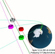
Software for visualization of satellite orbits